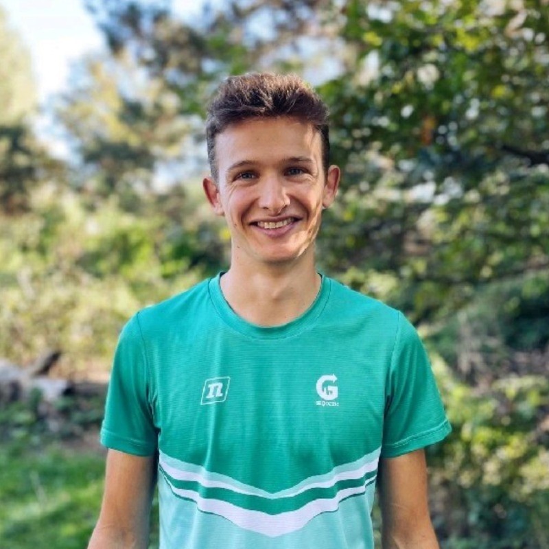
Le portrait de Nicolas Rio

Nicolas
Rio

Full Stack Engineer | Sveltekit | Geomatic

INSA Lyon

đź‘‹ Hello!

I’m an Information Technology Engineer with several years’ experience in full-stack web development and geomatics. Specializing in end-to-end project management, I support my customers from understanding their needs through to delivery, while guaranteeing tailor-made, robust and scalable solutions.

With solid expertise in front-end (HTML, CSS, JavaScript and TypeScript with or without framework) and back-end (Node.js, SQL), I also have skills in Geographic Information Systems (GIS) and mapping applications.

My strengths:

  • Ability to manage projects from A to Z, using a rigorous methodology and meeting deadlines.
  • Ability to make proposals and adapt quickly to new technical environments.
  • Passionate about technical challenges, I’m always on the lookout for innovative solutions.

I am available for one-off or long-term assignments. If you’re looking for an expert to turn your ideas into reality, I’m here to help!

EXPERIENCES

Fullstack Engineer | Parcours-orientation.fr

from to

Geodezic

parcours-orientation.fr

đź“– Background and challenges

Géodézic is a company specialized in orienteering events and tourism. It installs permanent orienteering courses, and organizes events around this activity. Géodézic needed a digital solution to facilitate the practice of orienteering on smartphones, in a fun and intuitive way.

🏗️ Implementation

  • Requirements analysis and technical design
  • Creation of a Progressive Web App (PWA)
  • Validation of control points via QR Code scan
  • Display of interactive content at each control point (simple content and questions)
  • Course results management (control points found, questions answered and timing)
  • Offline mode: can be used with an intermittent Internet connection
  • Full administrator portal to manage control points locations and interactive content.

🛠️ Technologies

  • Application framework: Sveltekit, Typescript
  • Database: Turso and Drizzle ORM
  • Mapping interface: Maplibre
  • Hosting: Cloudflare platform (Wokers, R2)
  • Requirements Analysis
  • SvelteKit
  • SvelteJS
  • UnoCSS
  • HTML/CSS
  • Typescript
  • SQLite
  • Progressive Web App
  • Maplibre
  • Cloud computing

Fullstack Engineer | Routechoice DB

from to

Fédération Française de Course d'Orientation

routechoice-db.com

đź“– Background and challenges

Orienteering is recognized by the French Ministry of Sport as a high-level discipline, and the French Orienteering Team supports the best French athletes for their preparation for international competitions. France is one of the world’s top 6 orienteering nations.

Faced with developments in the discipline, and the growing availability of performance data, the French team is constantly on the lookout for new analysis tools. I designed and produced Routechoice DB (routechoice-db.com), to support athletes in their day-to-day technical preparation.

🏗️ Implementation

Routechoice DB enables athletes to analyze their training sessions, giving them rapid access to relevant data and indicators:

  • Map display
  • GPS tracks
  • Split times between control points
  • Display of route options
  • Specific KPIs to competitive orienteering

An administrator portal enables coaches to add and manage training sessions and competitions.

Since the 2023 season, Routechoice DB has been used on a weekly basis by the PĂ´les France and French Orienteering Teams. Regular communication with the coaches of these structures has enabled the application to be progressively improved.

🛠️ Technologies

  • Application framework: Sveltekit with Typescript
  • Database: Turso and Drizzle ORM
  • Mapping interface: OpenLayers
  • Hosting: Cloudflare platform (Wokers, R2)

  • Requirements Analysis
  • SvelteKit
  • SvelteJS
  • UnoCSS
  • HTML/CSS
  • Typescript
  • SQLite
  • OpenLayers
  • Cloud computing

Fullstack Engineer | Mapant.fr

from to

Freelance

mapant.fr

đź“– Background and challenges

As part of the LiDAR HD program, France’s “Institut National de l’Information Géographique et Forestière” (IGN) is producing and distributing 3D mapping of all of France’s soil and subsoil using LiDAR data. This data opens the way to new and innovative mapping applications.

🏗️ Implementation

The Mapant.fr project aims to create the most accurate topographic map of France ever. The goal is to transform LiDAR data openly available, into a map complying with the ISOM 2017 standard, the most accurate specification for topographic maps. The resulting map can be used by the general public (hiking, outdoor competitions), as well as for professional applications (notably in forestry, where it can be used to map vegetation density).

As part of this project, I developed an open source software package: Cassini (cassini-map.com). To optimize map calculation time, it is implemented using the Rust programming language. The second part of the project consists in creating the infrastructure to distribute the computation on several servers.

🛠️ Technologies

  • Rust language
  • PDAL and GDAL geomatics libraries
  • Linux
  • Docker
  • Stripe (payments)
  • SvelteKit
  • SvelteJS
  • UnoCSS
  • HTML/CSS
  • Typescript
  • Geomatic
  • Lidar
  • GDAL
  • PDAL
  • Docker
  • Linux
  • SIG

Fullstack Engineer

from to

CGI

cgi.com

đź“– Background and challenges

As part of a team of fifteen engineers, I worked on the development and maintenance of the main business application for a major French energy company. The application enables the remote management of industrial PLCs, as well as the retrieval and processing of data from sensors.

🏗️ Implementation

As part of the team in charge of the application’s web portal, I took part in a major migration project from ASPX .NET technology to an Angular/Spring Boot stack. The high technical and business complexity of the existing application and the tight delivery deadlines made this a very rewarding experience.

🛠️ Technologies

  • Legacy: ASPX .NET
  • Frontend : Angular
  • Backend: Java Spring Boot microservices
  • Database: Oracle
  • Data processing pipeline : Kafka Bus
  • User Experience (UX)
  • HTML/CSS
  • Typescript
  • Angular
  • Angular Material
  • Oracle Database
  • Spring boot
  • Java
  • ASP.NET
  • OpenAPI
  • Architecture
  • Microservices
  • Single Page Application

Research & Development Engineer

from to

DĂ©cathlon

www.decathlon.fr/p/boussole-pouce-gauche-pour-course-d-orientation-racer-900-noir/_/R-p-313026?mc=8576047

đź“– Background and challenges

In 2019, Décathlon is launching the Géonaute brand, specializing in orienteering sports. In particular, the team is looking to improve the range of compasses sold by the brand. As part of an assignment via my school’s Junior Entreprise, followed by a fixed-term contract, I carried out a research and development (R&D) study on how compasses work.

🏗️ Realization

  • Reflection and documentation on compass design
  • Compass dynamic behavior equation
  • Creation of a numerical model for simulating compass physical parameters.

The high-end R900 compass model sold by DĂ©cathlon benefited from this R&D work.

🛠️ Technologies

  • Python language
  • NumPy and Pandas libraries
  • Research & Development (R&D)
  • Python
  • Numpy
  • Pandas

REFERENCES

Picture of Charly Boichut

“Thanks to Routechoice DB, our analysis are deeper and quicker, helping us to extract more benefits from our training. Its developper Nicolas Rio is super reactive to our requests, and even proactive with suggestions to keep it as the best tool available in the orienteering world.”

Charly Boichut | French Orienteering Team Head Coach

Picture of Pierre Martinez

“We used the parcours-orientation.fr application to organize a seminar for the Lyon Métropole with 500 participants. The display of questions, validation of control points, timing, scoring, etc. all worked perfectly, and the participants were delighted!”

Pierre Martinez | Founder of the Géodézic company

CONTACT

Nicolas Rio 2024

Built with Astro and Unocss

Source code github.com/NicoRio42/nicolas-rio-dev

Français